
Above the best map we have traced thus far covering the former lands of Frisia or of Frisians, and the basis for laying out the Frisia Coast Trail — you could say it is the Magna Carta Frisiae.
Maps and walking belong together. Not only that you need both when walking, but, in the past, when you wanted to make a map, you had to walk. The first detailed road map of the region of Ostfriesland was made by non other than Ubbo Emmius (1547-1625) from the village of Greetsiel. He did so by hiking a lot through the area (Dirks 2023).
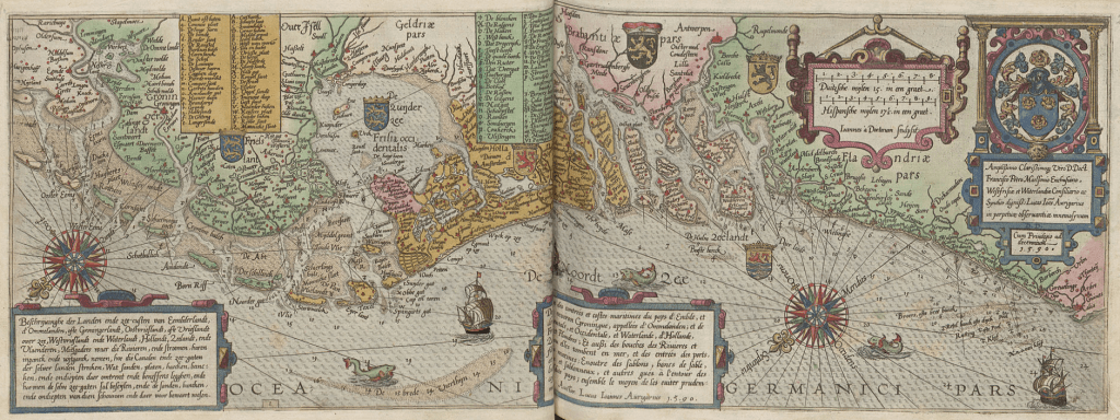
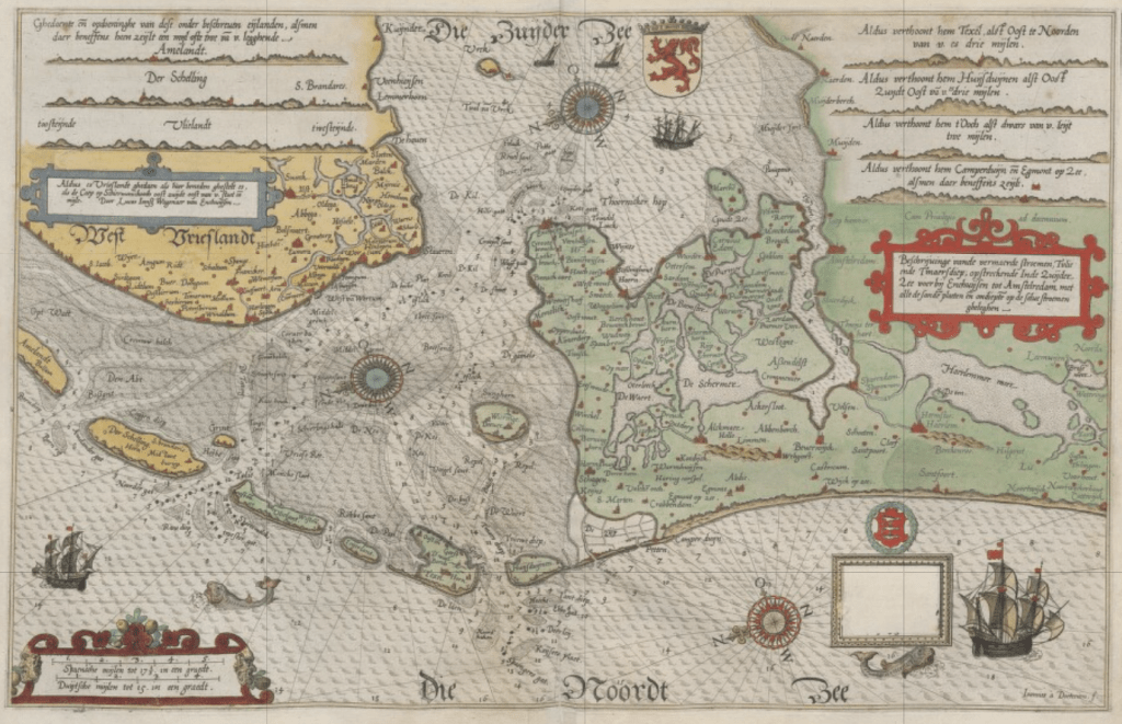
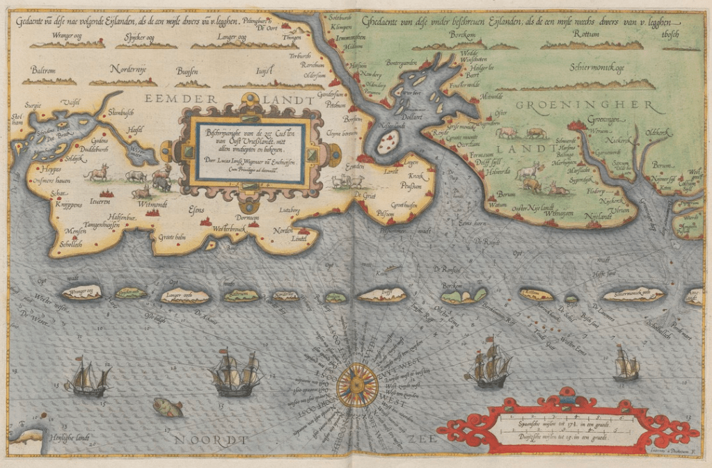
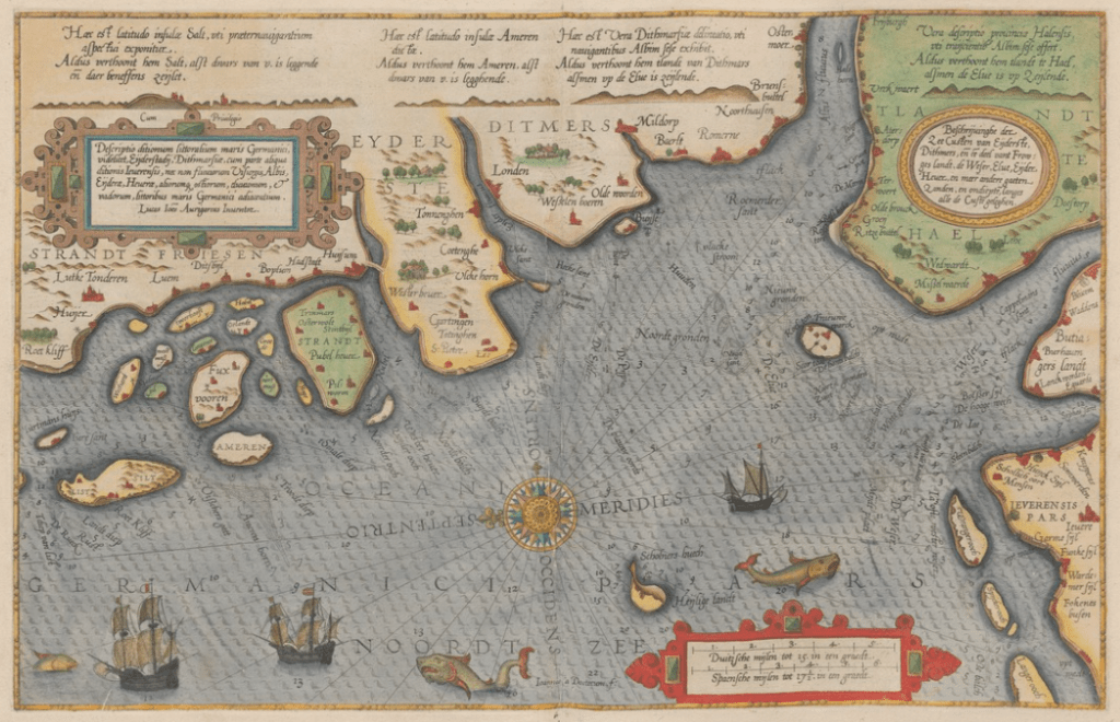
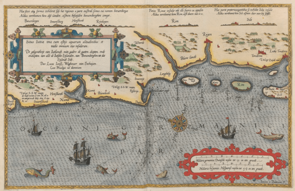
The first nautical charts in Northern Europe were created in the region of (former) Frisia. This was because navigation in the tidal waters of the Wadden Sea was particularly dangerous. The first charts were quite simple representations, but with the large-format atlas Spieghel van de Zeevaerdt by the West Frisian, born in the town of Enkhuizen in the region of Westfriesland, Lucas Janszoon Waghenaer, published in AD 1584-1585, cartography as a whole made a huge step forward in the world. For the first time, the coast of Frisia was properly mapped. Oh, and the rest of the world, too. More to the north, much of the cold Arctic was mapped by another Frisian: the legendary Willem Barentsz from the Wadden Sea island of Terschelling.
Below Waghenaer’s nautical charts, starting in the southwest in Flanders in Belgium following the coast all the way to the southwest of Jutland in Denmark; the Frisia Coast Trail as it were:

Trail Map
If the charts above are too unpractical for you to hike the Frisia Coast Trail, we have provided for an up-to-date Google Map with the trail. All different stages and sections separately available, including walking distance. Also, we have added different layers to the map, namely:
- The Trail
- Points of (historic) interest
- Parks & Conservation areas
- Lighthouses
- Shelter & Sleeping
- (music) Festivals
- Drowned islands
“History makes borders, the rest is geography”
Devoldere 2022
Following the very nature of the coast, we decided to split the hike by the rivers that subdivide the delta, and historically subdivided the different regions of Frisia. In total there are 9 stages to cover. In the drop down menu ‘Trail’ you will find a description of each stage, including links with a first and a visual impression of the stage.
Further reading
- Siebold, J., My Old Maps (website)
- Dirks, C.H., Geschichte Ostfrieslands. Von der Freiheit der Friesen bis zu witzigstem Otto (2023)

Heello mate great blog post
LikeLiked by 1 person
Thanks!!
LikeLike