Inlet the Zwin (BE) to River Lek (NL)
- Length: 295 km (185 miles) in 14 sections.
- Terrain: flat
- Region: West Frisia
This is the first stage of the trail, stretching from inlet the Zwin — early-medieval name Sincfala, also sincfalam or sincfalem — near the town of Knokke-Heist in the region of Flanders in Belgium, to the River Lek, a branch of the Lower River Rhine near the town of Wijk bij Duurstede, formerly Dorestat, in the province of Utrecht in the Netherlands. There is also a Zwin in the Netherlands which you will pass during stage 4 near the village of Elahuizen in the province of Friesland. So, check you are positioned at the right Zwin when starting the Frisia Coast Trail.
Trail Sections
- section 1.1: the Zwin — Breskens
- section 1.2: Vlissingen — Breezand
- section 1.3: Breezand — Burgh Haamstede
- section 1.4: Burgh Haamstede — Zierikzee
- section 1.5: Zierikzee — Bruinisse
- section 1.6: Bruinisse — Sint-Philipsland
- section 1.7: Sint-Philipsland — Dintelmond
- section 1.8: Dintelmond — Numansdorp
- section 1.9: Numansdorp — De Wacht
- section 1.10 : De Wacht — ferry Kop van Het Land/NP Biesbosch
- section 1.11: ferry Kop van Het Land/NP Biesbosch — Werkendam
- section 1.12: Werkendam — Leerdam
- section 1.13: Leerdam — Culemborg
- section 1.14: Culemborg — Wijk bij Duurstede
Description
According to the early-medieval law code the Lex Frisionum ‘Law of the Frisians’ this area belonged to the sub-region of West Frisia, the area inter Fli et Sincfalam ‘between the River Vie and inlet the Zwin’. The River Vlie does not exist anymore because the landscap it flowed though has turned into sea. Only the seaway with the name Vlie between the Wadden Sea islands of Vlieland and Terschelling gives away where once this river flowed approximately.
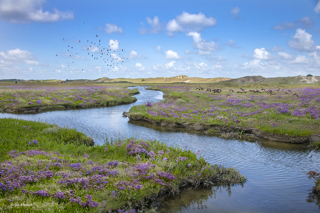
This stage covers the Netherlands’ Delta of the three mighty rivers Scheldt, Meuse, and Rhine. The hike starts at inlet the Zwin in the region of West Flanders in Belgium. Once an inter-tidal region intersected by streams and creeks connected with the North Sea. A landscape of salt marshes and dunes, where sheep farming was an important economic activity for centuries on end. After leaving inlet the Zwin behind you, the trail continues close to the coast of the North Sea entering the province of Zeeland. Here you will get an impression of the enormous Delta Works with among other the huge storm surge barriers in the River East-Scheldt. From the province of Zeeland the route heads northeast, leaving the North Sea coast, and via National Park De Biesbosch through the central river-land area of the Netherlands, in the direction of the city of Utrecht in the province of Utrecht.
In the Roman Period, the area along the coast south of the Lower River Rhine, i.e., the present-day provinces of Zeeland and Zuid Holland, was the territory of the Cananefates and the Frisiavones peoples. The Frisiavones were a to the Frisii, the Frisians proper, related people living within Roman or Romanised society. After the fall of the Roman Empire and after the Migration Period, the (new) Frisians from north of the Lower River Rhine extended their influence south up to the estuary the Zwin in the course of the sixth century. In the High Middle Ages, estuary the Zwin was crucial for the rise of the city of Brugges, until this city got into decline during the Late Middle Ages.
When you cross the River Scheldt, you enter the former island of Walcheren, today a peninsula. A place that was, during Roman and early-medieval times, an important stepping stone for the trade with the British Isles. It was even filled with Vikings receiving the benefits of the control over the River Scheldt. Read our blog post about the Walcheren and its heathen history.
Once your crossed the River Nieuwe Merwede with the ferry leaving at Kop van het Land, you enter National Park De Biesbosch. The best way to explore this area is via the water with a canoe, boat, or sup. After you reached the town of Werkendam, the trail continues along the UNESCO-listed (since 2021) Nieuwe Hollandse Waterlinie ‘new Dutch waterline’, which is a series of water-based defence systems of forts and natural bodies of water, including the possibility to inundate large section of land. The Nieuwe Hollandse Waterlinie runs from the town of Muiden in the north to National Park De Biesbosch at Werkendam in the south. The trail will follow the Waterline all the way to Muiden (see stage 2).
In the Early Middle Ages, especially during the seventh and eighth centuries, in the river-land area where the Lower River Rhine splits into the River Waal and the River Lek, the magnificent trade emporium Dorestat was situated. Where today the town of Wijk bij Duurstede is standing over its remains. Strategically connecting the trade with the North Sea and the Frankish hinterland on the border between Frisia and Francia, and for a long a cosmopolitan settlement filled with heathen Frisians and Norsemen and with Christian, Anglo-Saxons and Franks. It is here where the Frisian King Radbod, also written as Redbad, fought his battles with the Frankish Empire at the beginning of the eighth century; read our blog post about this (in)famous king, known by his cute pet name ‘The Enemy of God’.
Photo’s
For a first, visual impression of this stage, click here.
